
Park Ridge Neighbor Source Map
Public block research works best when every source has one job. CookViewer defines parcel relationships. The Assessor and Treasurer describe a parcel and tax role. The Clerk records title events. Election tools verify a specific voter or polling address. Local groups supply civic context, but none provides a complete list of Park Ridge neighbors.
| Source | What It Shows About a Block | Access |
|---|---|---|
| CookViewer Nearby Search | Target parcel, nearby PINs, map relation and boundary layers | Free county viewer; verify each parcel card |
| Assessor and Treasurer | Situs, class, tax details, mailing label and parcel facts | Free address or PIN search |
| Clerk recordings | Deeds and other title events for a chosen PIN | Online index; some copies require office access |
| Suburban voter information | Address-specific election information and match response | One address at a time; not a public block roster |
| Community organizations | Public group contacts, events and place context | Organization pages or direct inquiry |
An owner may live elsewhere. A tax-bill mailing address may differ from the situs. A permit applicant may be a contractor, and a voter match is limited to the purpose and fields of the election tool. Keep these labels intact instead of merging them into one claim about who occupies the block.
Define a Park Ridge Block
Begin with a normalized address and its exact parcel, then choose a small and clear scope. That may mean parcels sharing a boundary, lots facing the same short block, or a stated radius. CookViewer's address search can return a parcel nearby within about 100 feet, so confirm the PIN, street number and parcel shape before collecting adjacent IDs.
Cross streets and physical barriers matter. The rail lines, major roads and Forest Preserve edges described in the Park Ridge Comprehensive Plan can separate parcels that seem close on a list. A map-based boundary is more useful than an undefined search for nearby homes. For a whole named road rather than the immediate block, use the Park Ridge Street Directory workflow.
Map Park Ridge Neighbor Parcels
CookViewer is the main adjacent-parcel tool. It includes address and PIN search, Nearby Search, parcel layers, tax districts, political boundaries, archived imagery, reports and CSV or Excel export. Keep the task narrow. A block lookup needs only the parcels within the defined scope, not a bulk list.
- Search the target address and confirm its PIN and parcel outline.
- Run Nearby Search with a stated distance or click each parcel that shares a boundary.
- Record only the adjacent PIN, situs and map relation needed for the question.
- Open each parcel separately in CookViewer and the Assessor or Treasurer portal.
- Use the Clerk's PIN search only when a title interval is relevant.
The official parcel viewer shows the layers and controls used to move from one Park Ridge address to nearby lots.
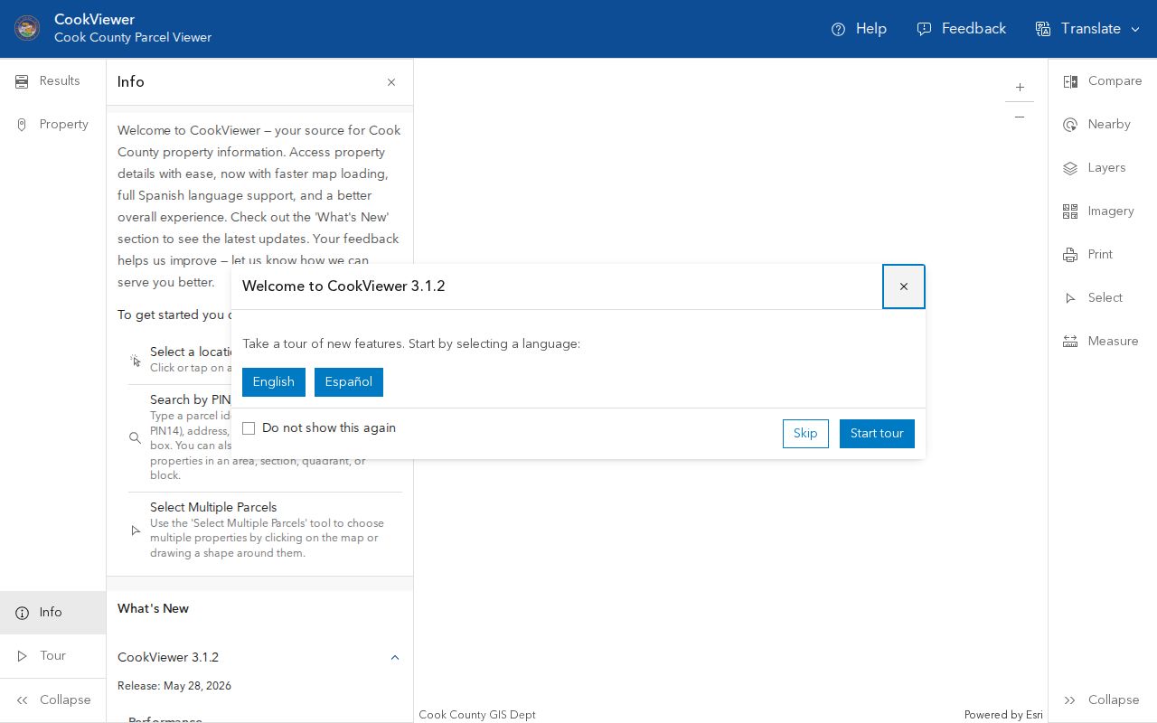
Recheck each card because a nearby result describes distance, not a social or household relationship.
Verify Each Park Ridge Parcel
After mapping the block, use the same PIN in the Assessor, Treasurer and Clerk systems. Compare the situs, property class, tax code, parcel description, exemptions and tax-bill mailing label. An exemption may be a clue, but the research does not support treating it as proof that a named person currently occupies the parcel.
Use a deed interval only when ownership history matters. Grantor and grantee identify parties to a transfer, not every person at the address. Trust and entity names are common. Mortgages, liens and releases explain finance or title events but do not identify neighbors. The safest notebook has one role column so owner, taxpayer, mailing addressee and resident never collapse into one.
When a parcel is a condominium, the street number alone may return several units or shared land. Match the unit, declaration number and legal description before reading an owner field. For a recent transfer, record both the instrument date and recording date. They answer different questions and can fall on different days. If an online image is unavailable, keep the index citation and use the downtown Cook County Clerk recordings desk rather than guessing from a document title.
Park Ridge Voter Address Check
The Cook County suburban voter-information tool is an address-specific verification route, not a downloadable neighbor list. Its captured fields include house number, direction, street, street type and ZIP. Use it to check election information for one supplied address and respect the system's limits.
The official screen shows why a Park Ridge block cannot be searched as a free-form roster.
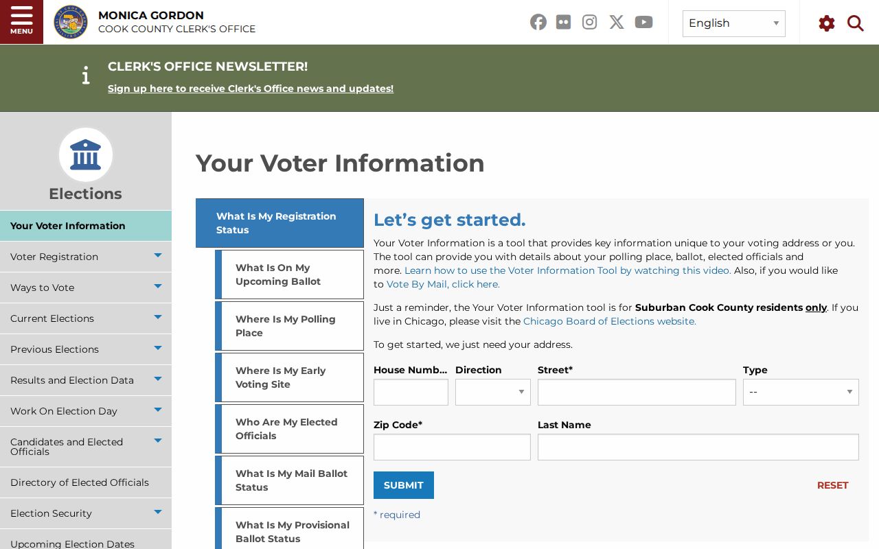
Illinois registration records and address protections carry use restrictions. The Address Confidentiality Program may keep a protected participant's name and address out of public voter lists. Never attempt to fill that gap from other records.
Park Ridge Planning Sector Layers
The 1996 Comprehensive Plan supplies six useful place labels: Northwest Park, Northeast Park, Maine Park, Centennial Park, Hodges Park and South Park. They help connect a block to roads, rail lines, parks, schools, civic sites and older newspaper terms. CookViewer can add tax-district, township, roadway and political-boundary layers.
These are planning-era descriptions, not current legal neighborhood-association boundaries. Northwest Park includes the Dee Road and Glenview frame; Northeast Park includes Country Club, Hinkley Park and the Busse corridor; Centennial Park includes the cemetery and Maine South area. Use a sector label as a search term, then confirm any present boundary with the City or current History Center materials.
Maine Park, Hodges Park and South Park add more search terms for older reports and newspapers. The History Center's neighborhood tours can explain why a street, institution or landmark matters. They are historical narratives, not proof of present membership or residence. Pair any tour statement with a dated map, directory page, parcel record or city file when the block question calls for firm evidence.
Park Ridge Community Connections
Community groups show how people gather around Park Ridge places, but their public pages are not resident rolls. Use them to find a group contact, meeting, tour or civic project tied to the block. Membership status should be learned from the group under its own rules.
Chamber Organizations
Public clubs and organizations directory with group contact fields.
Newcomers Club
A local social group founded in 1946, reached through its own membership page.
Garden Club
A Park Ridge civic group organized in 1929 with public organization information.
History Center
Neighborhood tours, historic sites and resident stories for place context.
The Park Ridge Chamber organizations directory illustrates the public group layer.
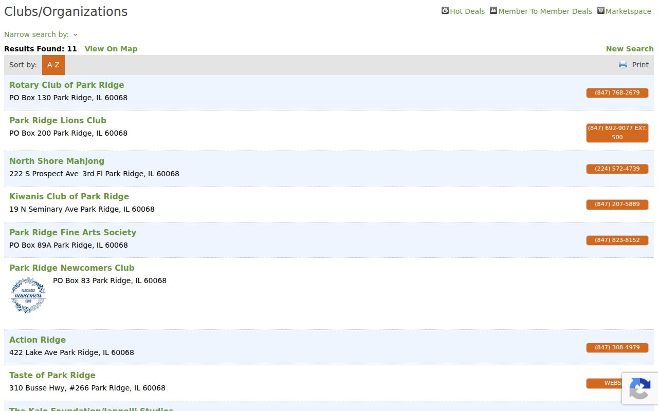
The entries identify organizations and public contacts, not every household on a nearby street.
Park Ridge Neighbor Tool Differences
Official sources are narrower than commercial neighbor tools, but their roles and custodians are clear. A commercial result may merge old addresses or same-name people without showing why. For civic and property curiosity, the official route makes each claim easier to test.
| Source Type | Strength | Limit |
|---|---|---|
| County parcel and tax sources | PIN, situs, geometry and dated property fields | Owner or mailing role is not occupancy |
| Clerk recordings | Documented title events and legal descriptions | Does not list all household members |
| Official voter tool | Specific address verification under election rules | No public block roster |
| Commercial category | May combine broad public and licensed data | Sources, dates and matches may be unclear |
Repeat a Park Ridge Block Check
A short capture list keeps each nearby parcel separate and makes later review possible. Record the normalized target address, target PIN, map date, adjacent PINs, cross street, source date, printed role and any uncertainty. Add permit, zoning or historical-directory evidence only if the question calls for it.
- Target address, ZIP, PIN and exact map point
- Adjacent parcel IDs and their direction from the target
- Situs, mailing and owner labels kept in separate fields
- Deed or permit interval with source date
- A clear note stating what each result does not prove
CookViewer's archive can compare parcel context from 2000 onward. Save only what the task needs. A change in a parcel outline can explain a record mismatch without saying anything about the people nearby.
Park Ridge permit and zoning records can add a civic layer when a nearby project is the real question. Search by a precise address or permit number in Civic Access. If the public portal does not expose the file, Park Ridge GovQA is the records-request fallback. Ask for a defined permit history, plat, inspection or hearing file and a date range. A permit applicant, architect, contractor or hearing participant may have no residential tie to the block, so retain the exact role shown.
Park Ridge Neighbor Privacy Limits
No official public block-level neighbor directory or adjacent-owner export was found. Renters and other household members may not appear in land records. Utility and delivery data are not public shortcuts. Illinois FOIA also permits exemptions for personal privacy, safety and other protected interests, so a custodian may redact or withhold details even when a related record exists.
Use the least data needed. Do not publish full birth dates, protected addresses, account numbers, victim information or extra mailing addresses. Do not join records on a common name alone. If a public index is wrong, seek correction from the source office instead of spreading the error.
Lawful use. Look up Park Ridge neighbors only for lawful civic, personal or property research. Never use public records to watch, harass, intimidate or harm anyone.